As employees of the City of Los Angeles, we are continuously striving to bring the public a wider range of accessibility to our resources with the most up-to-date methods of data extraction available.
We now provide the public with worldwide internet access to our NavigateLA website. NavigateLA is an interactive GIS mapping system developed by our Public Works Department- Bureau of Engineering (BOE. As a web user, you are privileged to have access to many of the GIS features that have been located with GPS technology throughout our city at the following web address: NAVIGATELA.LACITY.ORG.
NavigateLA map instructions can be viewed and printed in Adobe pdf format: USER MANUAL
PARK TREES: The Forestry Division of the Recreation and Parks Department has begun an intense tree inventory program designed to identify and preserve our city's important natural resources. The tree references can be viewed and the data can be downloaded to Microsoft Excel on NavigateLA.
For more information visit: HERITAGE TREES or you may contact Forestry personnel at (213) 485-4826
Instructions for Using the Park Trees Layer
I. To view and search the mapped park trees on NavigateLA:
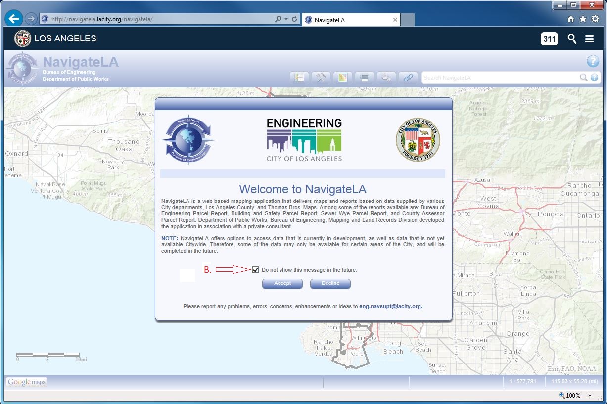
1. Click the link below (A.)
2. Accept conditions of the disclaimer (B.)
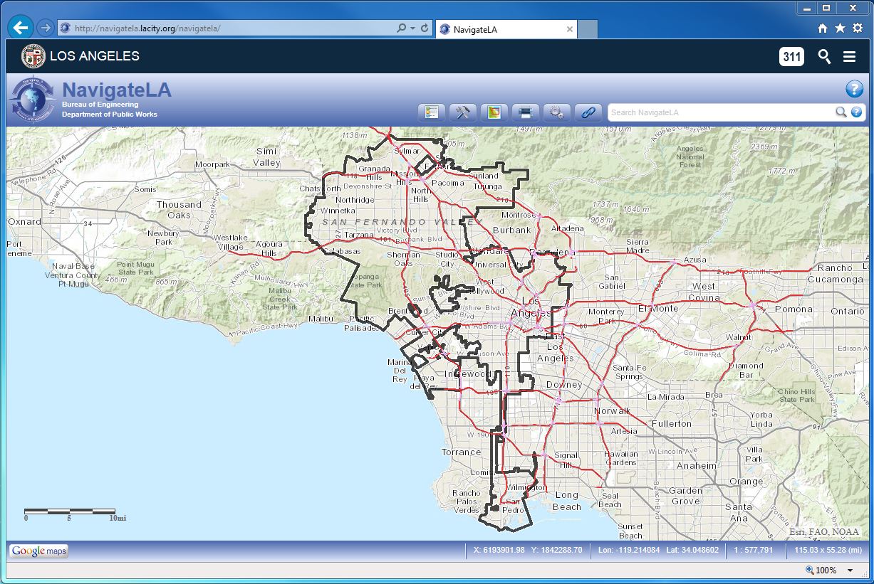
II. The next screen should look similar to this:
III. To view mapped park trees:
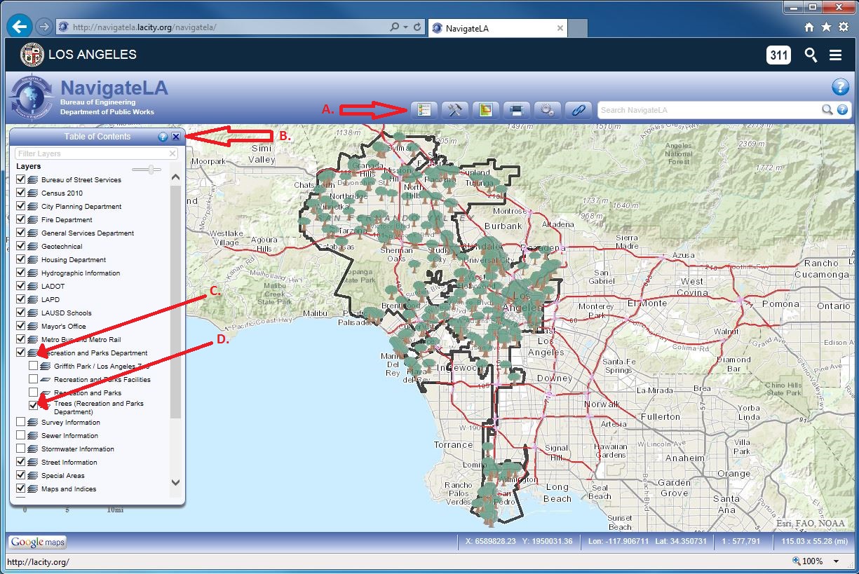
1. Click the Menu Button (A.)
2. Table of Contents Menu Pops Up (B.)
3. Click on the Tiles new to "Recreationa and Parks Department (C.)
4. Check the Box next to Trees (D.)
III. To Zoom In on the mapped park trees:
1. Click the Tools Button (A.)
2. Click the Zoom In Button (B.)
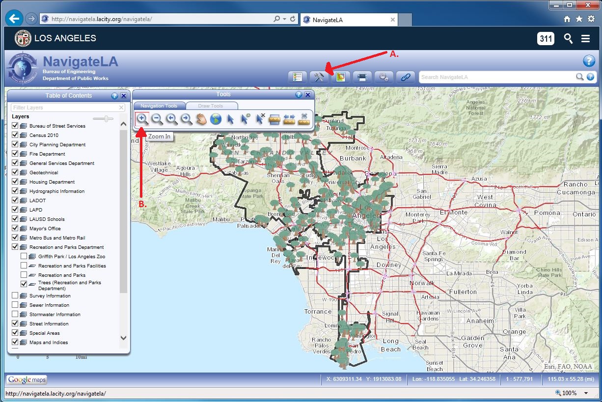
V. To zoom to a select screen size:
1. Click on one corner of the new view and hold down the mouse button (A.)
2. Drag the mouse and release the button at the opposite corner of the new rectangular view (B.)
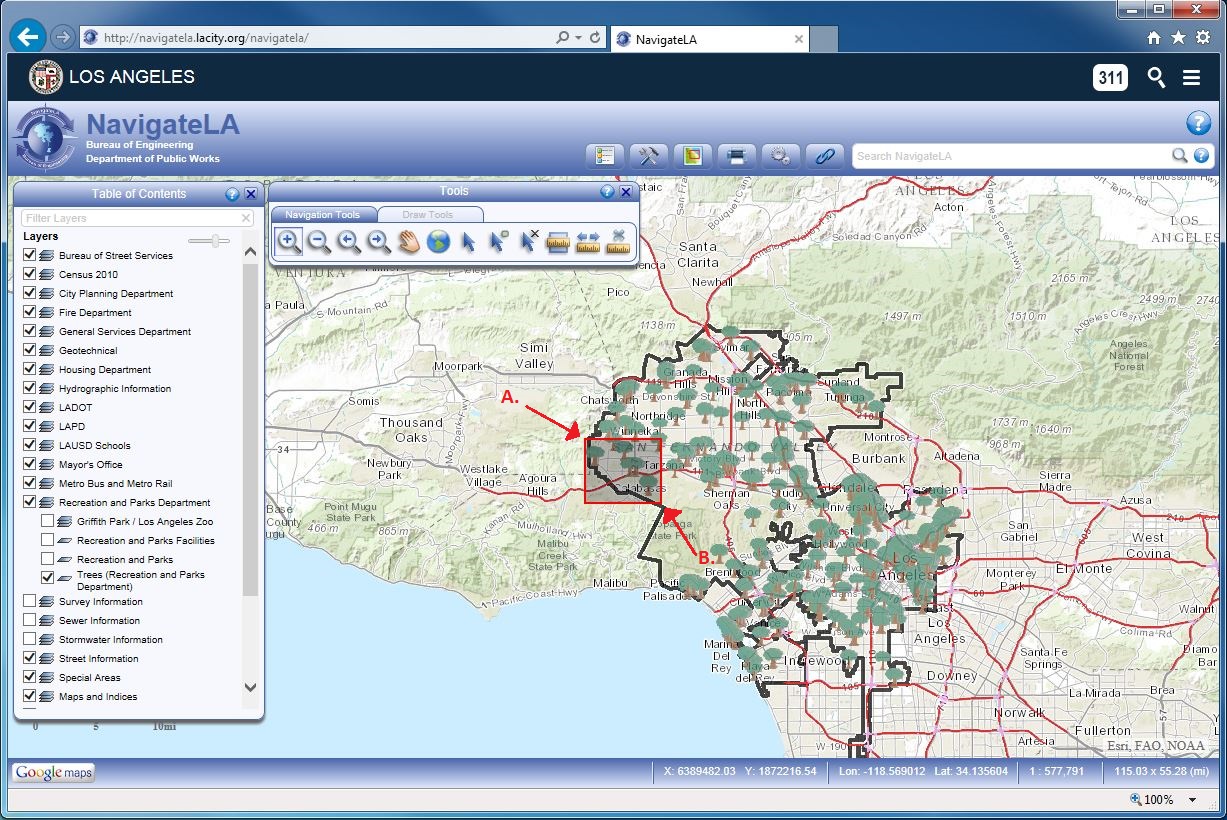
VI. To view a quick description of a tree:
1. Click on the "Select a Feature" tool (A.)
2. Position the mouse pointer (still) on a tree and click the tree (B.)
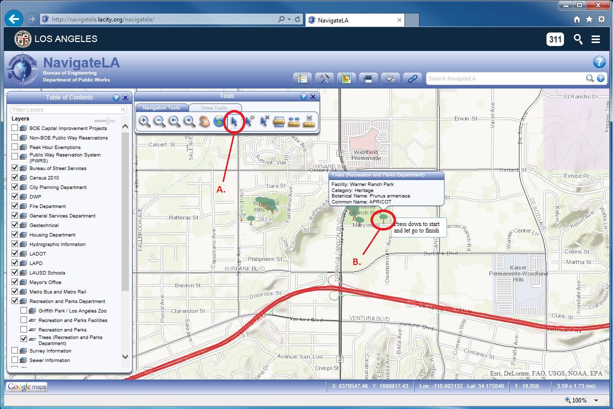
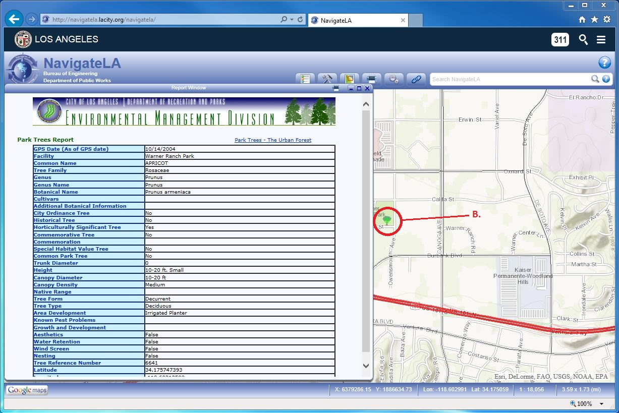
VII. Or, double click on the tree to pull up the tree report (A.):
